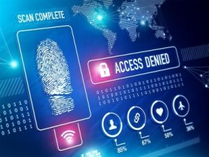
Building the Case for Digital Evidence

Every crime has digital evidence, whether it's a suspect's cell phone, a witness's cell phone video, camera footage from a doorbell, a fitness tracker, or data from any number of IoT devices and sensors. This wealth of digital data is both an asset and a challenge for law enforcement. Six out of ten professionals now rank digital evidence as more important than DNA evidence. However, the sheer volume of digital evidence--the average device holds 60,000+ messages, 32,000+ images, and 1,000+ videos--provides challenges for understaffed teams that often rely on manual processes to review these valuable assets.

As digital evidence continues to grow in volume and importance, law enforcement agencies across the nation are looking for ways to more efficiently review, manage, and secure this critical asset. Continue reading

3 Ways Public Safety is Utilizing Cutting Edge Technology

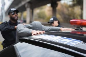
In an effort to continue to keep us safe, law enforcement and other first responders are embracing and responding to the implementation of new technologies. In this post we'll take a look at three technology areas impacting how law enforcement carries out their mission - video, autonomous vehicles, and Internet of Things.

Video Improves Transparency and Public Collaboration

Body and dash cameras were originally introduced in the United Kingdom in 2005, followed by large-scale implementation in the United States in 2014. Their wide application was designed to "make police services more transparent and officers more accountable." The technology has proven its worth. For example, only 2.1% of citizen complaints filed in Chicago between 2010 and 2016 resulted in a disciplinary action against police officers, according to the Invisible Institute. Part of this was due to the fact that investigations were carried out internally by police departments with little outside input. A recent study found that today, with the use of video evidence, police officers are 64% more likely to be subject to disciplinary action after a complaint investigation.

Recording the footage is only part of the solution to best using video. That footage must also be widely distributed to help in identifying suspects. In doing so, departments have to be mindful of privacy issues of others who may have been recorded. Video redaction can be a time consuming process that wastes valuable hours. Today, departments are utilizing AI-enabled redaction cutting the process down to minutes.

Continue reading

A Short History of Shared Services…and What’s Next.

Shared Services in government is nothing new. The idea began in the 1980s with the consolidation of payroll and some other administrative functions. In the '90s the focus was on creating entities that could provide common business functions across government and, in that effort, become a cost center.

The 2000s saw the rise of the term 'Line of Business' that looked at common business functions across government to identify opportunities to transform, streamline and share. The Obama Administration looked specifically to IT as a shared service, releasing the Federal IT Shared Services Strategy that provided federal agency chief information officers and key stakeholders guidance. This guidance focused on the implementation of shared IT services as a key principle of their efforts to eliminate waste and duplication, with the intention to reinvest in innovative mission systems.

Continue reading

FirstNet Serves Those First on the Scene

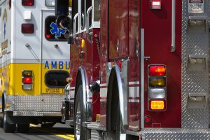
FirstNet is a nationwide wireless broadband network for first responders being built and deployed through a first of its kind public-private partnership. FirstNet was borne out of the September 11, 2001 tragedy where it became clear that the radio systems police, fire, and paramedics relied on did not easily operate across agencies. First responders also could not rely on land and mobile phone lines as they were overwhelmed by a high volume of calls. The 2004 9/11 commission report cited this lack of connectivity as a fundamental problem for first responders and pushed for solutions to be developed quickly to support everyday public safety activities as well as response to catastrophes.

The development of FirstNet began in 2012 when the First Responder Network Authority was established and a law was put in place that allocated 20 megahertz of spectrum and $7 billion to establish a broadband network dedicated to the nation's first responders. FirstNet was launched in 2018.

Continue reading

Mapping out Geospatial Uses

Geospatial, as a strict term, means data that is related to a location. In the government space, Geospatial has been used interchangeably with GIS - or Geographic Information Systems - which refers to technology that uses geospatial data. GIS has long been a key technology for the military and intelligence communities to help map out and gain visibility into areas for combat or missions. But as the availability of geographic data grows through the use of GPS applications, drones, and IoT technologies, the use of GIS is expanding across government.

GIS is a key tool in disaster response helping overlay available resources and assets onto maps of areas impacted by floods or fires. It can also be used to map in real time the location of hazards such as downed power lines.

GIS is also being used by law enforcement. In one case, a boy had gone missing, suspected to be abducted. The boy posted a photo to Instagram and the image, taken from what seemed to be an apartment window, included a sign on a bank across the street. An analyst looked up branch locations and cross-referenced the addresses with online maps, but could not get a location that seemed to be a possible match. When they took that data and loaded it into a GIS system that took a top-down look at locations they were able to pinpoint the location of the child.

Urban sprawl and growth is also being managed with GIS. The city of Durham, NC uses aerial imagery to get a better look at changes being done to properties that impact land use, water runoff, and drainage.

There are several upcoming events focused on GIS as well as others that include discussion of the application of geospatial technology. Continue reading